


Select NOAA-NWS Forecast Office Text Products
(Product availability varies with seasons, forecast office, and weather.)
Forecast Discussion for Dallas/Fort Worth, TX
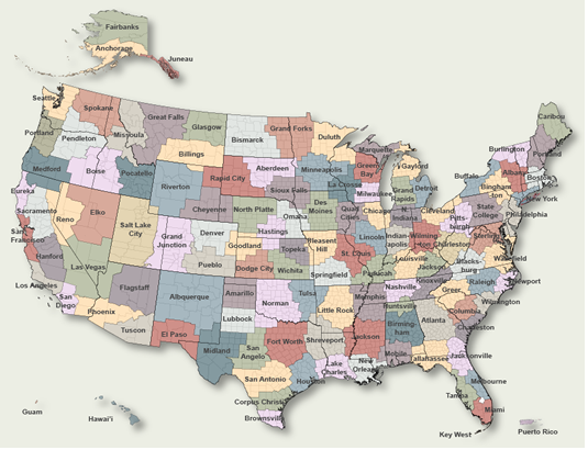
To Select Another NWS Office Click on Map or Choose from List
|
| Select Forecast Office: | Select Product: |
548 FXUS64 KFWD 241918 AFDFWD Area Forecast Discussion National Weather Service Fort Worth TX 218 PM CDT Fri Jul 24 2026 ...New SHORT TERM, LONG TERM, AVIATION... .KEY MESSAGES... - A Heat Advisory remains in effect across much of North Texas through 8 PM Saturday. Heat index values up to 106 degrees are expected. - Additional Heat Advisories may be needed into early next week. && .SHORT TERM... (This evening through tonight) Issued at 151 PM CDT Fri Jul 24 2026 Remnant tropical moisture associated with the remnants of Bertha continues to linger across North and Central Texas today, resulting in widespread cloud cover that has been slower to erode than previously anticipated. Morning observations, satellite imagery, and ACARS soundings all support a slower destabilization of the boundary layer, with temperatures warming more gradually across much of North Texas while portions of Central and Southeast Texas have seen more substantial clearing. As a result, afternoon highs have been trended a few degrees cooler than previous forecasts across the cloudier portions of the forecast area. Despite the lower temperatures, dewpoints have also been slower to mix out, allowing heat index values to still be on track to climb to near or locally just above Heat Advisory criteria this afternoon. While advisory-level conditions should be somewhat less widespread than in recent days, confidence remains high enough to maintain the current Heat Advisory through 8 PM with no configuration changes. Light drizzle remains possible through the afternoon, primarily across portions of Central Texas where deeper moisture lingers, but coverage should remain sparse with most locations staying dry. Any activity that develops will diminish this evening, leaving another warm and humid night with lows generally in the mid to upper 70s. && .LONG TERM... (Saturday through next Thursday) Issued at 151 PM CDT Fri Jul 24 2026 Little change is expected in the overall pattern through next week as an expansive mid-level ridge remains the dominant feature across the southern CONUS. Temperatures will gradually climb through the weekend and into early next week as cloud cover becomes less prevalent and the ridge strengthens overhead, with widespread highs in the upper 90s to lower 100s expected by Monday. While some afternoon boundary layer mixing should provide modest reductions in dewpoints, humidity will remain sufficient for heat index values to routinely reach Heat Advisory criteria, and additional daily heat headlines are anticipated. In fact, a Heat Advisory has already been issued for much of North Texas on Saturday, including the far northeastern counties that are expected to remain just below criteria today. Rain chances will remain minimal beneath the ridge, with little relief from the prolonged stretch of hot and humid conditions likely through much of next week. && .AVIATION... (18Z TAFS) Issued at 151 PM CDT Fri Jul 24 2026 MVFR ceilings are continuing to slowly lift across the Metroplex this afternoon, with low VFR prevailing at the remaining Metroplex terminals. Continued mixing should lift and scatter the remaining stratus later this afternoon, leaving VFR conditions through the rest of the period. Although areas of drizzle or a few brief light showers cannot be ruled out beneath the lingering moisture plume, coverage and confidence in direct terminal impacts remains too low for inclusion in the TAFs. Southeast winds near 10 kts will become more southerly and increase to around 13-15 kts through the afternoon. && .SPOTTER INFORMATION STATEMENT... Spotter activation is not expected at this time. && .PRELIMINARY POINT TEMPS/POPS... Dallas-Ft. Worth 81 101 81 102 / 0 0 0 0 Waco 77 97 77 99 / 0 0 0 0 Paris 79 96 77 99 / 0 0 0 0 Denton 80 101 80 102 / 0 0 0 0 McKinney 79 99 80 102 / 0 0 0 0 Dallas 81 100 81 103 / 0 0 0 0 Terrell 78 99 77 100 / 0 0 0 0 Corsicana 77 98 77 100 / 0 0 0 0 Temple 75 97 75 98 / 0 0 0 0 Mineral Wells 77 100 76 101 / 0 0 0 0 && .FWD WATCHES/WARNINGS/ADVISORIES... Heat Advisory until 8 PM CDT Saturday for TXZ091>094-100>105- 116>123-131>134. Heat Advisory from 8 PM this evening to 8 PM CDT Saturday for TXZ095-106-107. && $$ SHORT TERM...12 LONG TERM....12 AVIATION...12 |
Previous Forecast Discussions may be found at
NWS Dallas/Fort Worth, TX (FWD) Office Forecast Discussions.
(Click 'Previous Version' there to view past versions successively.
Some may differ only in time posted.)
Products Courtesy of NOAA-NWS
NWS Information Parsing Script by Ken True at Saratoga Weather - WFO and Products Scripts by SE Lincoln Weather.
Mapping by Curly at Michiana Weather and by Tom at My Mishawaka Weather.